National Aeronautics and Space Administration
Goddard Space Flight Center
Search:

Balloon Program Office
Operations
Fort Sumner, New Mexico
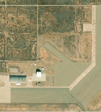
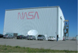
Columbia Scientific Balloon Facility (CSBF) Fort Sumner is located at the Fort Sumner Municipal Airport, New Mexico. CSBF Fort Sumner consists of a large World War II hangar (used for equipment and launch vehicle storage - as well as science payload storage and integration), a NASA payload processing facility that includes offices and an operations control center, and a launch pad. The site, partially owned by Fort Sumner Village, is a former Army Air Corps Base that eventually became the Fort Sumner Municipal Airport. The village of Fort Sumner lies to the southwest, with lands immediately surrounding the CSBF facility being generally vacant, and privately owned.
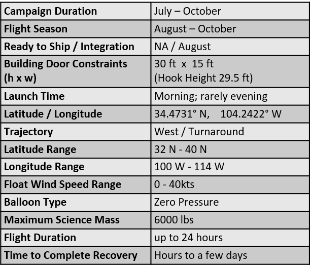
Most of the balloon flights are scheduled during either the spring or the fall campaign periods at CSBF Fort Sumner. The spring campaign, if taking place, typically occurs from March to June; the fall campaign typically takes place August to October. It is during these periods that stratospheric turnaround occurs. Turnaround is a period of a few days when the stratosphere above the jet stream (approximately 30 to 46 km above the earth [19 to 28 mi]) slows down and changes zonal direction. As a result, balloons remain aloft nearer to the launch facilities. The turnaround period also allows the balloon to stay aloft for a longer period of time thus extending the periods for experimental instruments to collect data. Turnaround flights only occur at Fort Sumner.
The mission profile will allow eastward or westward flight trajectories between 28 degrees north and 40 degrees north, generally constrained within 31 degrees to 38 degrees north. The operational boundary is a rectangle defined by top left coordinates of 40.5 degrees N, 116.25 degrees W, and bottom right coordinates of 31.5 degrees N, -97.5 degrees W and excluding areas within 50 nautical miles of the border between the United States and Mexico; a self-imposed operational limit by CSBF to ensure that there is no risk of overflight into Mexico or impact on Mexican territory. Flight durations range from approximately four hours to approximately 24 hours, depending on the launch date and its relation to stratospheric wind patterns. During the first part of the campaign, upper level winds are primarily from east to west. Population patterns allow for termination in this period over New Mexico, Arizona, and California– sometimes Colorado, Oklahoma and Kansas, depending on risk criteria. These risk criteria may limit the float duration to approximately four hours. A similar situation is in effect during the latter part of the campaign, but float winds from west to east and termination over Texas, Oklahoma, or Kansas limit the duration. Longer flight times of up to 24 hours may occur during the turnaround period in the middle part of the campaign, when upper level winds result in a trajectory remaining nearer to the launch site.
View Larger Map
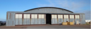
Building 1 - Hanger
- Balloon and Equipment Storage
- Payload integration bays
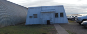
Building 2 - Office
- CSBF Launch Team
- Rigging
Building 3 - Flight/Staging Facility
- Payload Integration area
- Meteorology Department
- Electronics Lab
Building 6 - Kitchen
More information on Fort Sumner Airport
NASA Code 820
Scientific Balloon Update
Report back for the latest update from NASA's Balloon Program Office.
- NASA Official: Debora Fairbrother
- Point of Contact: Angelique Kinney